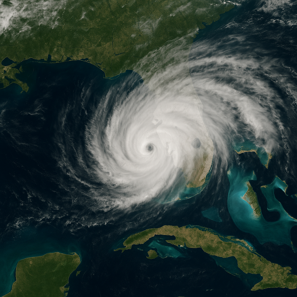
Hurricane Season in Florida: Dates, Preparedness, and Impact
Key Takeaways
- Florida’s hurricane season is from June 1 – November 30, but storms can form prior and post these dates, so advance planning is a must.
- Florida’s most dangerous hurricane season is mid-August to mid-October, with September 10 being the most dangerous single day, statistically speaking.
- Florida’s geography as a peninsula, along with warm water and winds, puts the state in particular danger of hurricanes from both the Gulf and Atlantic shores.
- Because early season storms can develop quickly in the vicinity of Florida, while later season storms frequently emerge from tropical waves off Africa, you should pay attention to forecasts all season long.
- Hurricanes are not just about the wind. Storm surge, rain and flooding threaten outside of the forecast path.
- Those who live or vacation there need to make sure they’ve got a well thought out plan. Be sure to keep up with local weather alerts, and think about flood insurance.
Hurricane season in Florida begins June 1 and concludes November 30 annually. While the majority of storms strike between August and October, September is frequently the most dangerous. Living in Florida means extra care at these months because storms can bring with them wind, rain and flooding. Both coastal and inland residents can be impacted. The following post discusses what to anticipate and how to be safe during hurricane season.
Florida’s Hurricane Season Defined
Florida’s hurricane season is a time of increased tropical storm and hurricane danger, as state leaders and local populations remain vigilant for any looming hazards like hurricane warnings. The season’s timing isn’t random; it’s molded by centuries of storms, making it crucial for Floridians and tourists to understand hurricane preparedness activities and when to brace for impact.
1. Official Dates
Florida’s hurricane season lasts from June 1 to November 30, as determined annually by NOAA. During this time, residents and visitors should closely monitor weather reports and engage in hurricane preparedness activities for potential storms. With Florida being the most storm-slammed state, having experienced over 120 tropical cyclones since 1523, early awareness and preparation are crucial for minimizing hurricane damage.
2. The Unofficial Start
Some years, storms develop prior to June even getting underway, and these tropical disturbances don’t always receive the fanfare. They have the potential to expand quickly and strike strong, which is why it’s wise for Floridians to begin their hurricane prep work in late May rather than waiting until June. Keeping an eye on the news and checking weather apps for updates on tropical development is a good habit, especially since the Gulf and Atlantic waters warm quickly, making early storms not uncommon.
3. Peak Activity
The peak of hurricane activity occurs from mid-August to mid-October, with September 10 being the statistical peak for hurricane conditions. Nearly all of the major hurricanes—96 percent—form during this stretch, with forecasts predicting potentially as many as 25 named storms, including 8 to 13 hurricanes with sustained winds exceeding 74 mph for Florida. It’s smart to have your hurricane preparedness activities in place, as refreshing those plans as the peak nears cuts down last-minute stress and danger.
4. Season’s End
Hurricane season wraps up on November 30, but storms post this date, while unusual, can still occur. December has previously seen late-season action, making hurricane preparedness activities crucial. As history has shown, tropical cyclones can be unpredictable and don’t always adhere to the calendar, emphasizing the need for vigilance.
Why Florida Is a Hurricane Magnet
Location, location, location — Florida falls directly between the Atlantic Ocean and the Gulf of Mexico, making it one of the most hurricane-hit states in the nation. This position places it in the heart of where many tropical cyclones originate and travel. The state’s hurricane season, which stretches from June to November and coincides with the hurricane watch period, poses an elevated threat annually due to potential hurricane damage.
A Peninsula’s Peril
Because of Florida’s peninsula shape, storms can strike from the Atlantic or Gulf, or even wrap around from the Caribbean. Both the Gulf Coast and Atlantic Coast are at grave risk–storms don’t have far to go to get to land. The southeast coast is in peril, yet no area of the state is resistant. Storm surge and flooding can occur miles inland, as well as at the shore.
For smarter hurricane planning, lay of the land knowledge counts. Local features, such as low-lying areas or barrier islands, can alter impact and who receives the brunt of a storm.
Warm Water Fuel
Hurricanes feed on warm water, and Florida’s practically swimming in it. When ocean water warms to 80°F or above, it’s time for storms to develop and intensify. Both the Atlantic basin and Gulf Coast supply this fuel, which is why so many storms make a beeline for Florida. As the climate warms and waters heat up, more powerful storms could become more frequent.
Sea temps are now an integral aspect of hurricane tracking and forecasting.
Prevailing Wind Patterns
Trade winds blow many storms west from Africa directly toward Florida. Certainly, there are times when high pressure systems shove storms out, but shifts in the upper level winds can redirect storms back or weaken or strengthen them. One little shift in the wind can send a storm north instead of right into Miami.
Being able to anticipate these changes allows meteorologists to improve forecasts on a storm’s location and intensity.
Florida’s Long Coastline
So Florida’s coast is over 1,300 miles – more points of attack by hurricanes. This extended finger of coastline places cities, towns and rural areas in harm’s way near annually.
Even further inland can get absolutely hammered with rain and wind.
The Season’s Evolving Rhythm
Florida’s Atlantic hurricane season is an ever-evolving rhythm from June to November, with storms varying in origin, intensity and behavior throughout the season. With this rhythm in mind, residents and businesses remain vigilant and prepared. The table below shows how storm development patterns change through the season:
| Timeframe | Where Storms Form | Typical Path | Main Threats |
|---|---|---|---|
| Early Season | Near U.S. & Florida | Gulf & Caribbean | Quick formation, rain |
| Mid-Season (Peak) | Off Africa, Open Atlantic | Westward to U.S. | Strong winds, surge |
| Late Season | Caribbean, Gulf | Northward | Heavy rain, flooding |
Early in the season, storms have a tendency to develop near Florida, occasionally in the Gulf of Mexico or western Caribbean. Later, as the ocean warms, tropical waves off Africa are more prone to whirling into hurricanes. Due to things like ENSO status and warming oceans, continued watching is important. Soojin, residents have to rethink their plans as the season shifts.
Early Season Threats
Early season storms can come up quick, sometimes with little notice. Not infrequently, we see early June or July systems generate in the Gulf and impact FL before a lot of folks are prepared.
Best to be prepared for June gales. Basic things like checking weather alerts, stocking supplies and reviewing local plans provide assistance. In 2024, a tropical storm made its way in early June and drenched South Florida. 2012’s Tropical Storm Debby, which spun up so fast it flooded random areas of the state.
Mid-Season Intensity
The season culminates in August and October, when storms tend to be the most intense. Hot waters, humid air and breezes help make more hurricanes. ENSO phases such as La Niña in late 2024 and neutral years before it have all delivered very different seasons.
| Season Stage | Typical Storm Strength | Key Needs |
|---|---|---|
| Early | Weak/moderate | Quick readiness |
| Peak | Strong/major | Full preparedness |
| Late | Weak/moderate-strong | Keep monitoring |
Meteorology in mid-season: warm Atlantic waters, low wind shear, and active tropical waves boost storm numbers. Four major hurricanes expected in above-normal 2025 season. One sure way to get back on track is by checking your emergency plans as August approaches.
Keep your eyes open. Check property insurance and refresh storm kits ahead of peak months.
Late Season Surprises
Late season storms can be fierce, too. October and November have delivered hurricanes to Florida, such as Hurricane Kate in 1985, that struck the Panhandle just prior to Thanksgiving. The warm gulf and changes in the jet stream can assist late storms to develop.
With the season officially ending on November 30 it’s simple to let your guard down after Halloween. Late storms can cause heavy rain, flooding and wind. The 2024 season had a November system loomed to threaten the Gulf of Mexico Coast.
Stay on top of your local weather news. Reliable sources are the National Hurricane Center and local emergency managers.
Do not ignore late-season warnings.
Beyond the Cone of Uncertainty
The cone of uncertainty is a product developed by the National Hurricane Center (NHC) to present the probable track of a hurricane, including hurricane warnings and potential hurricane damage. This cone, occasionally referred to as the ‘cone of death’, assists individuals in Florida identify potentially threatened regions; however, it does not indicate the exact locations where all impacts will occur. The cone is shrinking—3 to 6 percent smaller for the 2025 season—because forecasts are better than they used to be. Storm surge and wind warnings will be issued sooner, up to 72 hours in advance, extending to inland counties as well. Hurricanes aren’t linear, and damage frequently occurs beyond the cone.
The Forgotten Impacts
Wind is not the only danger. Flooding is frequently underestimated, but it can be equally destructive. In hurricanes, storm surges can shove water miles inland, flooding streets and homes. Even if your house isn’t in the direct path, heavy rains swell rivers and lakes, causing flash floods.
Inland counties are not immune to these impacts. NHC’s new warning system now marks both coastal and inland areas under threat. Flood damage can wipe out homes and cars and roads, even a great distance beyond where the eye of the storm passes.
Comprehensive preparation means thinking beyond wind. Take action to verify flood zones, protect important documents and plan for immediate evacuations. Mind the updates, even if you’re outside the cone.
Water, Not Wind
Water damage during hurricane events frequently exceeds the cost of wind. Slow storms can dump over a foot of rain, flooding homes and roads, even if winds never approach hurricane strength.
Flood insurance is crucial. Regular home-owners insurance doesn’t cover flooding. See if your home is in a flood zone and purchase a plan now.
Evaluate your building for flood potential. Identify potential areas of pooling or leakage, flush drains and gutters prior to the storm.
Conclusion
Florida’s hurricane season is June to November, with the bulk of it occurring from August to October. Big storms can come, but not every year is a major. People down here recognize the routine—fill up on water, gas, and canned food and watch the forecast. A lot of us still remember Irma or Ian and keep their go-bags primed. Being prepared keeps you resilient and ready to aid neighbors. Florida’s weather can flip fast, so a little prep goes a long way. For the freshest advice, consult local forecasts and confide with friends who’ve survived it. Be safe, be savvy and don’t be a procrastinator–get ready today.
Frequently Asked Questions
When is hurricane season in Florida?
Hurricane season in Florida, which spans from June 1 to November 30 annually, often sees hurricane watches and warnings issued, especially between August and October.
Why does Florida get hit by so many hurricanes?
Florida’s position between the Gulf and Atlantic makes it a prime target for many tropical systems and hurricane damage.
What is the peak month for hurricanes in Florida?
September marks the peak of hurricane season in Florida, when forecasters predict the majority of major hurricanes and tropical storm conditions.
How can I prepare for hurricane season in Florida?
Put together an emergency kit, have an evacuation plan, and monitor local weather updates for hurricane preparedness activities. Preparation is protection.
What does the “cone of uncertainty” mean?
The “cone of uncertainty” indicates the potential track of a hurricane’s center, helping forecasters predict hurricane conditions and guide coastal communities toward hurricane preparedness activities.
Are hurricanes getting stronger in Florida?
Florida’s hurricanes, influenced by warmer ocean temperatures and tropical development, have been stronger in recent years, prompting professionals to recommend hurricane preparedness activities.
Do all parts of Florida face the same hurricane risk?
Coastal areas and South Florida face higher hurricane risks, but storms can impact the entire state, so hurricane preparedness activities are essential every hurricane season.
Leave a Reply